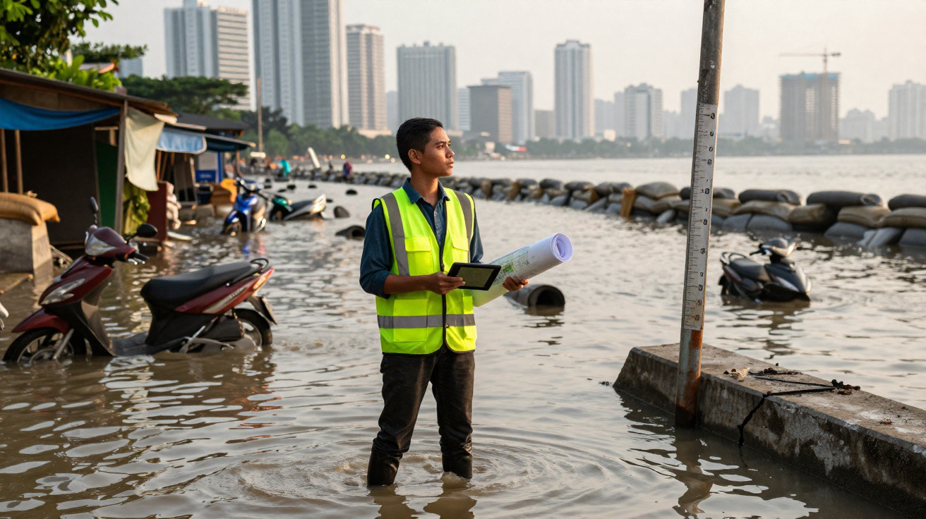
In a tropical capital dominated by skyscrapers and traffic jams, the ground is quite literally giving way beneath residents’ feet.
The planet’s newly largest megacity faces a stark paradox: while millions lack drinking water, the land is sinking and the sea is steadily advancing, threatening to swallow entire neighbourhoods within this century.
The megacity that grew too quickly
Jakarta, Indonesia’s capital, has just overtaken Tokyo as the world’s largest urban agglomeration, according to a UN report released in 2025. Including its metropolitan area, it has about 42 million residents across 664 km².
That growth has brought chaotic urban development: densely packed neighbourhoods, limited infrastructure, continual congestion and outward expansion into mangroves, floodplains and naturally exposed areas. This mix is now colliding with another decisive factor: the city’s land is subsiding while sea levels rise year after year.
Jakarta is simultaneously facing three powerful pressures: land subsidence, rising seas and extreme rainfall intensified by the climate crisis.
Why the world’s largest city is sinking
The leading cause of subsidence cannot be seen with the naked eye: excessive groundwater extraction. In many districts, particularly poorer ones, the public water network cannot meet all demand. With no alternative, households and small businesses use wells and pumps to draw water directly from underground aquifers.
When too much water is removed, the ground loses its support. Underground layers compact and the surface sinks. In parts of northern Jakarta, this subsidence exceeds 20 centimetres a year-an extraordinary rate for such a populous city.
The problem is compounded by the sheer amount of concrete. Tarmacked roads, car parks, buildings and pavements create an impermeable crust, preventing rainwater from soaking into the ground and replenishing underground reserves.
- Intensive groundwater extraction in neighbourhoods lacking an adequate network
- Soil compaction and the gradual sinking of land
- Sealed urban surfaces that hinder aquifer recharge
- Heavy construction on fragile, flood-prone land
Together, these factors have turned Jakarta into a dramatic example of how urban choices and infrastructure failures can create large-scale geological risks.
When the sea rises and the land sinks
As the ground drops, the sea level around the city is rising by 2 to 4 centimetres annually, according to regional estimates linked to global ocean-level rise. This creates a form of “double pressure”: the city goes down as the sea comes up.
In northern Jakarta, some neighbourhoods already lie below sea level. These districts avoid permanent inundation only because of dykes and flood walls, which regularly fail. When breaches occur, residents face sudden flooding, loss of possessions and lengthy periods of cleaning and rebuilding.
Across several parts of the Indonesian capital, water is scarce from taps yet plentiful in flooded streets.
Heavier rain and a fragile drainage system
As if this were not enough, Jakarta experiences periods of heavy rain from October to March. The climate crisis is making these events harsher, with storms concentrated into just a few hours. The city’s already ageing and undersized drainage network cannot cope with the volume.
The same outcome returns every year: streets become rivers, canals overflow and homes are flooded. For those living in lower-lying areas, a severe downpour can mean lost furniture, interrupted work and exposure to illnesses associated with contaminated water.
Environmental and public health crisis
The subsidence and flooding crisis overlaps with another chronic issue: pollution. Air containing high concentrations of particles, dark rivers and rubbish-filled canals form part of everyday life. This combination worsens respiratory illness, skin conditions and cases of diarrhoea, especially among children.
Experts warn that places exposed to frequent flooding tend to accumulate sewage, solid waste and standing water. This encourages the spread of bacteria and disease-carrying mosquitoes, including those that transmit dengue and chikungunya.
| Risk | Immediate consequence | Long-term effect |
|---|---|---|
| Land subsidence | Cracks in homes, distorted roads | Entire neighbourhoods below sea level |
| Sea-level rise | Saltwater entering coastal areas | Loss of habitable land |
| Extreme rainfall | Flooding, localised landslides | Falling value of vulnerable areas |
| Urban pollution | Asthma attacks, infection outbreaks | Greater strain on the health system |
A capital at risk of partly disappearing
Projections cited by specialists point to a grim outlook: by 2050, around one-third of Jakarta’s area could be severely affected unless structural change takes place. This includes both the accelerating subsidence of neighbourhoods and seawater encroachment along sections of the urban coastline.
The danger is not merely geographical. It affects millions of socially vulnerable people living in fragile homes, often in informal areas, without insurance or savings that would allow them to relocate.
When a megacity sinks, poorer people are the first to lose their homes, their work and access to essential services.
The radical plan: building a new capital
Faced with this impasse, the Indonesian government has chosen an ambitious solution: moving the country’s capital to another island. The new city is called Nusantara and is being built in Borneo, more than 1,200 kilometres from Jakarta.
The scheme, valued at about US$35 billion, is intended to ease pressure on the existing megacity by redistributing part of the public administration and investment. The plan is to relocate federal bodies, ministry headquarters and a portion of civil servants.
Its timetable, however, is lengthy. Full completion is not expected before at least 2045, and several stages still face political disputes, funding obstacles and environmental concerns in Borneo, a region containing sensitive tropical rainforest areas.
Dykes, barriers and local measures
While Nusantara progresses unevenly, Jakarta is attempting to buy time. Authorities have built dykes, strengthened sections of the coastline and announced plans to upgrade the drainage network. There are also targeted efforts to reduce groundwater extraction by expanding the treated-water distribution system.
These actions help contain the situation in the short term, but they do not reverse the accumulated effects of decades of unplanned development. Every season of intense rainfall brings another test to the city’s streets.
What it means for a city to “sink”
Technically, this phenomenon is known as subsidence. Put simply, it is the gradual lowering of land relative to a reference point, which may be sea level or a fixed marker.
It can happen for natural reasons, such as the compaction of sediment over time, but in Jakarta human activity carries much greater weight: groundwater extraction, the weight of buildings and changes to the course of rivers and canals.
One way to picture the impact is to imagine a coastal neighbourhood sinking by a few centimetres each year. Over a decade, the cumulative difference can allow a high tide that once caused no disruption to enter streets and homes.
Possible scenarios for the coming decades
If current rates of subsidence and sea-level rise persist, parts of Jakarta may increasingly have to live with permanent flooding, forcing internal migration. Low-income districts are likely to be squeezed between inundated areas and high-value neighbourhoods, deepening inequality.
An alternative scenario, supported by urban planners, combines several measures at once: strict limits on drilling wells, expanded water provision, restoration of green areas, a redesigned drainage system and more robust coastal defences. Delivering it requires major investment and political coordination-something complex in any megacity.
Other coastal cities, from South-East Asia to Latin America, are watching Jakarta closely. The same mechanisms-groundwater extraction, rapid urbanisation and rising seas-are already emerging to varying degrees in places such as Bangkok, Manila and even parts of Brazil’s major capitals.
For residents, governments and urban planners, Jakarta now serves as a tangible warning: decisions made in recent decades about water, land use and coastal development are shaping not only the city’s map, but also the very possibility of living there for generations to come.











Comments
No comments yet. Be the first to comment!
Leave a Comment